UCSB New Venture Competition
Aerial Intelligence
for Wildfires
Vegetation fuel analysis before and after the fire, hotspot detection throughout.
The Problem
Prescribed burns are the best ways to stop wildfires and they're flying blind.
Fire departments need to know what's fuel-heavy, what's at risk, and what burned before and after a controlled fire. Right now they walk the land themselves. We built a drone that does it autonomously: fly a grid, generate a map, hand it to the crew.
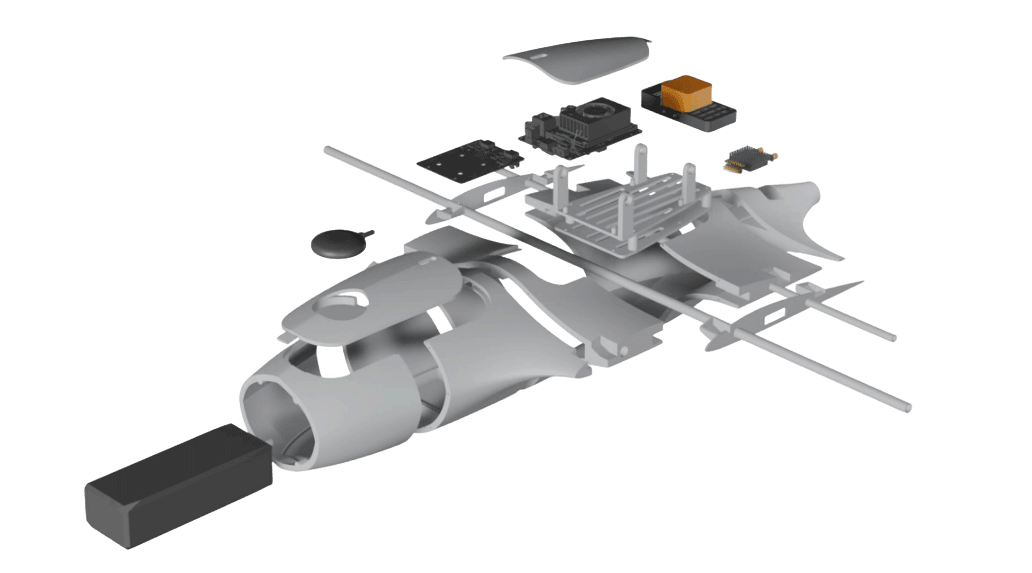
The Hardware
Custom VTOL platform with thermal camera, RGB sensor, LiDAR, flight controller, and GPS. Takes off vertically, transitions to fixed-wing for area coverage, lands itself.
Sensor Suite
.png&w=3840&q=75)
LiDAR
.png&w=3840&q=75)
Boson Thermal Camera
.png&w=3840&q=75)
RGB Camera
Autonomous Flight
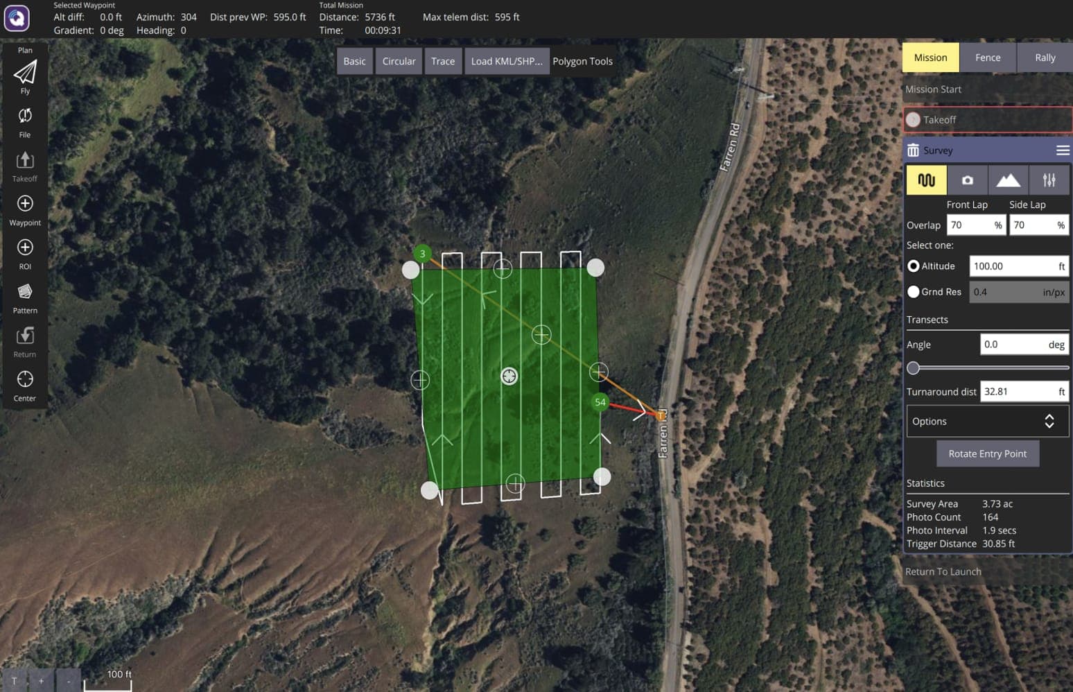
Draw a boundary. It does the rest.
Operators define the survey area and the system generates a full lawnmower flight path with photogrammetric overlap.
Outputs
Two data products. One flight.
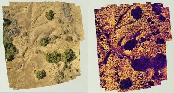
RGB + Thermal Imagery
The RGB map gives spatial context: terrain, trees, access routes. The thermal overlay reveals heat signatures invisible to the naked eye: hot spots and residual burn.
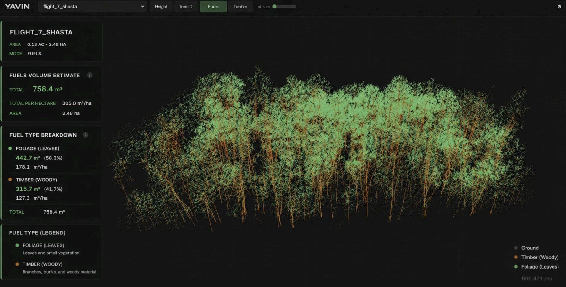
LiDAR Vegetation & Fuel Volume Mapping
LiDAR point clouds generate volumetric estimates of vegetation density. Fire crews get a quantified fuel load map showing exactly how much material is in a given area.
Recognition
3rd Place — UCSB New Venture Competition
$5,000People's Choice Award
$2,500Impact Award
$2,500Total
$10,000Documentation
Design Packet
Full system design — Spring 2026